Dr Colette Jeffrey Associate Professor of Wayfinding at Birmingham City University on why hospital wayfinding is so difficult
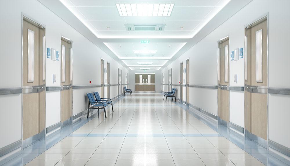
Successfully finding your way in an unfamiliar hospital is challenging for most people even with clear wayfinding signs. Giving consistent, legible information that uses simple language and standard symbols is important, but your patients and visitors may still lose their way. Our ability to process information on signs and make wayfinding decisions is affected by anxiety, worry and pain. People who are stressed will struggle to remember medical destination names and complicated spoken directions. So what can hospitals do to make wayfinding systems simpler?
Wayfinding strategy
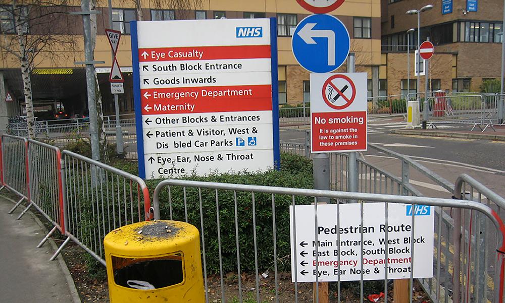
Firstly, a hospital needs to understand the wayfinding problems at their site, then develop a wayfinding strategy specific to solving their unique issues. No two hospitals have all of the same wayfinding problems, but many need to solve similar issues. Common wayfinding challenges are hospitals with multiple external building entrances, buildings with similar sounding names, corridors on different levels that look too similar. Multiple buildings connected by a single main corridor can cause confusion when patients don’t realise they need to use a specific lift to get to another floor and they use the wrong lift and get lost.
Hospitals built on a hill will always have issues naming entrances and levels as people expect to enter the hospital on Ground Level in the UK, or Level 1 in other countries, so when going to a department on Level 2, they are likely to enter the building and look for a lift and go up two floors. Having very prominent sign saying ‘You are on Level Y’ at every entrance point and on every floor is essential for hill-side hospitals. Some use Level A, B, C, D to avoid level numbering confusion, others use generic theme names such as Forest Level and Sky Level. But are level letters and names still problematic, especially at a site that also uses letters and names for zones, or buildings or wards?
Simplification
Most large hospitals have too many facilities, departments, wards and buildings to list on one sign or map, so site simplification is critical to avoid creating enormous signs that are not easily updated and are visually overwhelming. Finding ways to enable grouping of wayfinding information into smaller ‘chunks’ creating a hierarchy of information that is easier to scan through is challenging, but an important stage in developing your wayfinding strategy. There are many ways to simplify a site and no single approach is appropriate for all hospitals.
Simplification enables patients to create a ‘mental map’ or simple image of the site layout and for designers to create simpler maps and signs that are as simple as possible and therefore easier for everyone to understand. In a 1960 study published as Image of the City, Kevin Lynch first introduced the concept of ‘way-finding’ and identified five elements that affect people’s ability to create an image of a place such as a hospital. These are nodes, districts, landmarks, paths and edges. “A legible city [or hospital] would be one whose districts or landmarks or pathways are easily identifiable and are easily grouped into an overall pattern” Thirty years later, in Wayfinding: People, Signs and Architecture, architect Romedi Passini and graphic designer Paul Arthur identify four more complicated, but useful types of circulation system patterns a hospital could use to make a place wayfinding-friendly – shoestring pattern, gestalt pattern, systematized pattern and network or repetitive pattern, believing “it is the combination of too many decision points and not enough information that gets people lost.”
Models
More recently in The Wayfinding Handbook, David Gibson identifies four models for organising a hospital signage scheme (see image below). The Connector model is where a connecting corridor links together other routes and is used at Queen’s Medical Centre and Nottingham City Hospital in Nottingham, UK. The Districts model is where the site is divided into geographical groups of buildings such as named wings and is also used at Queen’s Medical Centre. The Landmark model is where features, such as public lifts, are named or numbered to create landmarks for wayfinding and is used at St Thomas’ Hospital in London. The fourth model is the Street model where corridors are given street names making it easier to direct people, but also potentially causing confusion with external street names. Many sites use two of these models to create a simplification system that works.
Hospital changes
Hospital site layouts are constantly changing, with new buildings being added, old ones being demolished, entrances moving and departments relocating. Having a wayfinding strategy that considers future changes and simplifies the site in some way will make it easier for people to overcome these inevitable changes. An effective wayfinding system considers three interconnected factors – people, information, and the environment. If your information is well-designed and consistent, and people giving spoken directions use the same names that are on the signs, patients will find wayfinding easier. If reception staff have been trained to give clear directions, using simple language and the same terms that appear on the signs, patients are likely to find their way. If you have distinct, recognisable landmarks along main routes and at key decision points that direction-givers can refer to, patients may remember it on their return journey.
Time saving and safety
Can you reduce the amount of time your staff spend helping lost patients find places by improving your wayfinding system? Are people missing appointments at your site and arriving late or so anxious that their test results are affected? Getting lost usually results in a negative patient experience but has even been fatal. In 2018, a new mother got lost in a UK hospital trying to find her way back to the maternity ward from the special care baby unit. She mistakenly entered a dis-used staff area where she collapsed and remained unfound for seven hours and tragically she died from a brain haemorrhage two days after being found. A similar tragedy occurred in a shopping centre in Australia in 2017 when a man aged 71 mistakenly entered a fire stairwell and was not found until three weeks later, by which time he had sadly died. In both these cases, getting lost was not the main cause of death, but had they not got lost, they may both still be alive.
Understanding how different people find their way, and how a patients’ cognitive state affects their wayfinding decision making is important for all hospitals to develop an effective wayfinding strategy will help make it easier for people to avoid getting lost in your hospital.
Research
In Design That Cares, Jane Carpman and Myron Grant state that “wayfinding involves five deceptively simple factors: knowing where you are, knowing your destination, knowing and following the best route to your destination, recognising your destination upon arrival and finding your way back out”. In Wayshowing, Per Mollerup agrees, believing that “wayfinding is a spatial problem-solving process” and he identifies three different activities “search, decision and motion – to seek, to decide and to move”. Mollerup also introduces the concept of ‘wayshowing’ where “wayfinding and wayshowing relate to each other as do writing and reading... or cooking and eating. One activity deals with sending, the other with receiving. The purpose of wayshowing is to facilitate wayfinding.”
The author of this article co-wrote the official NHS Wayfinding: Guidance for Healthcare Facilities in 1999 and hopes to be commissioned to produce a revised version, with digital wayfinding ideas. It is out-of-print but can be downloaded for free from here.
Technology
Through our research we found that “many factors affect how people orientated themselves and find their way, but wayfinding is essentially a series of inter-related decisions influenced by personal and environmental factors and also by the availability and understandability of information”. The theory seems relatively straightforward and consistent, but we found the reality of solving wayfinding problems in complex, ever-changing hospitals, with many different users, was not a simple task. Over a period of twenty years, Colette’s design teams have audited more than thirty UK hospitals, developed wayfinding strategies and designed information based on the NHS Estates guidance.
How people find their way to a hospital appointment has changed over the last ten years. People with disabilities plan their journey in detail so the content and accessibility of a hospital’s wayfinding information is important.
In 2009, 28 per cent of car users in the UK had a Satellite Navigation device (SatNav), and with the number of in-car SatNavs fitted as standard, this figure has increased significantly. A hospital’s postcode was rarely used for wayfinding ten years ago but now hospitals need to provide their full address, including a postcode for people to enter into their SatNav. They also need to check online mapping such as Google Maps shows the site in the right place when the postcode is entered.
Many companies in the UK offer touch screen technology used for wayfinding and hospitals that have been audited recently have screens in patient areas, but they are more often used for surveys and information messages, rather than offering interactive mapping and site directories. The future for cost-effective interactive information for hospitals is most likely to utilise mobile phones, with specific wayfinding information sent direct to a phone at each stage of the journey, giving relevant information as the user needs it, using global positioning technology to tell users where they are and where they need to go, creating routes shown on the phone screen, supported by audio information.
Communication
Communication is the key. A hospital wayfinding system should use consistent terminology at every stage of the user’s journey and should be kept up-to-date.
Achieving these two key goals requires clear and regular communication between different departments – the estates and facilities team, management teams, the capital projects team, strategy planners and most importantly the staff who deal directly with patients on a day-to-day basis. Hospitals in the UK are large, multi-disciplinary organisations, located in multiple buildings and operating across different sites.
They are managed by even larger NHS Trusts and funded by the government. Whose job is it to make sure signs and maps are kept up to date when departments are relocated, merged, renamed or closed down?
Often wayfinding strategies are given to the estates department to try to implement. At a large UK hospital, a new privately financed (PFI) building for main outpatients had been erected and occupied but the estates manager had never been inside and he had not been allocated funding to update internal or external signs in the rest of the site to show the routes to the new building.
About the author
Dr Colette Jeffrey is Associate Professor of Wayfinding and Inclusive Design in the School of Visual Communication at Birmingham City University.
She is currently advising Birmingham Children’s Hospital on their wayfinding system and writing a book to be published early 2024 on why people get lost in buildings based on her PhD study of indoor wayfinding and waylosing.